
 Script Planner Assistant▸
 AI Apps
 AI News

BIGEMAP: Free Download of High-Definition Maps for All Regions of China
BIGEMAP: Free Download of High-Definition Maps for All Regions of ChinaIntroduction
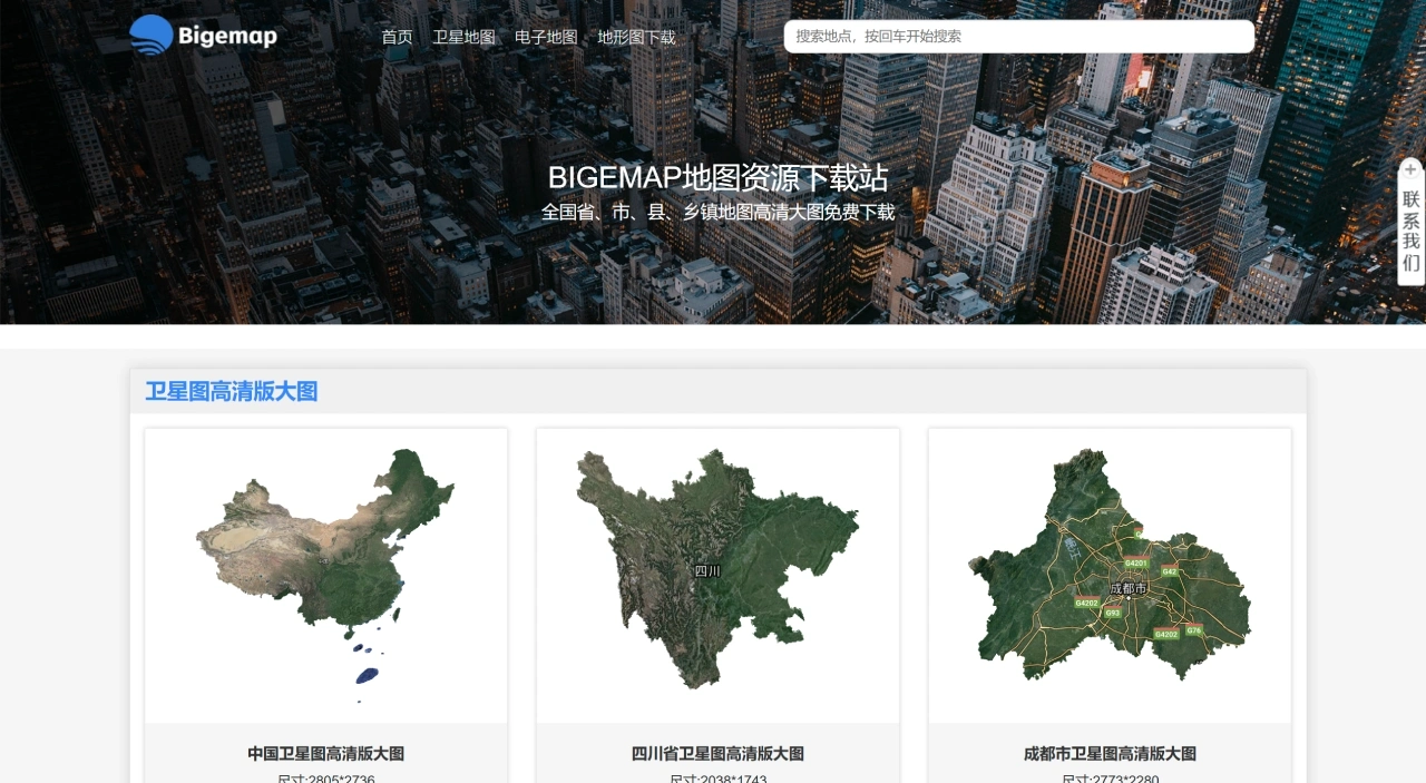
The BIGEMAP map resource download station is actually integrated into the "Data Source Market" of the desktop software (Map Downloader). After installing the genuine client, there is no need for third-party websites, and you can directly download the following watermark-free high-definition map data, including online downloading of high-definition maps of provinces, cities, counties, and townships across the country. The types cover Google satellite maps, electronic maps, Google topographic maps, and more.
BIGEMAP Main Data Types
Imagery
Sources: Google satellite, historical imagery, Baidu/Amap/Tencent/Tianditu satellite, Bing, Mapbox, Sentinel-2, Landsat, etc.
Resolution: up to 0.25 meters
Download methods: support downloading by province/city/district, rectangular area, polygon range, or route
Vector
Content: Global/national road networks, water systems, building outlines, POIs, subway/bus, administrative divisions, place names, etc.
Export formats: shp, kml, dwg, dxf, and other common GIS/CAD formats
Elevation and Terrain
Data: SRTM3, ASTER GDEM, global 12.5/30/90-meter precision elevation
Functions: one-click generation of contour lines (dwg/shp/kml/Excel), profile analysis, 3D terrain models
Thematic Maps
Types: land cover, vegetation distribution, geological maps, nautical charts, 2.5D city models, population heatmaps, meteorological cloud maps, and more than 50 others
Offline Publishing Packages
Automatically converted to Google/Baidu/ARCGIS standard tiles, supporting intranet offline publishing or secondary development
BIGEMAP Operation Process
Download and Install
Visit the BIGEMAP official website to download the Windows/macOS/Linux version
Choose the Full Version (includes all data sources)
Download Steps
Log in to your account → click "Map Source" or "Data Center" in the upper left corner
Select the required layers and area → set resolution/format → click "Start Download"
Data is watermark-free by default and includes coordinate information (WGS84, can be converted to Beijing 54/Xi'an 80/CGCS2000), suitable for scientific research, surveying, and mapping scenarios
Mobile Sync
"My Layers" on the desktop → right-click "Sync to Phone" → log in to the APP with the same account to view offline, annotate, and measure distance
BIGEMAP Online Quick Download
Open the resource catalog page and filter maps by region/type
View the parameters on the download page (e.g., Chengdu City map: 2773×2280 pixels, scale 1:867402, recommended print size 0.69×0.57 meters)
Directly download a single 4000×4000 pixel map (suitable for 1×1 meter printing)
For larger sizes/higher resolutions:
Free authorization supports data below level 17 (apply via the official QQ group)
Level 17 and above usually requires payment
Online browsing: unauthorized users can view level 18-20 imagery (approximately 0.5-meter resolution), but cannot download
BIGEMAP Advanced Usage
Format conversion and analysis: use with Bigemap GIS Office for projection conversion, data editing, or map output
Resolution explanation: single direct-link download max 4000×4000 pixels; authorization for level 17 and above requires payment
BIGEMAP Frequently Asked Questions
Q: What map types does BIGEMAP provide? What areas does it cover?
A: It includes three types of high-definition large maps: satellite maps, electronic maps, and topographic maps, covering all of China (including province/city/district/street level, such as Sichuan Province, Chengdu City, Wuhou District, Guixi Street).
Q: How are map parameters labeled? Take Chengdu City as an example?
A: Clearly marked size (e.g., 2773×2280 pixels), scale (1:867402), and recommended print size (0.69×0.57 meters).
Q: What are the service advantages of BIGEMAP?
A: Free provision of multi-level high-definition maps with clear parameters that can be directly referenced; some maps additionally label highways (e.g., G4201), rivers (e.g., Minjiang River), and landmark names (e.g., South Railway Station) for practical use.