
 Script Planner Assistant▸
 AI Apps
 AI News

Zoom Earth Chinese: Real-Time Global Satellite & Weather Forecast Platform
Zoom Earth Chinese: Real-Time Global Satellite & Weather Forecast PlatformIntroduction
Zoom Earth is a platform for viewing real-time satellite imagery and weather data. It offers high-definition satellite maps, various weather conditions, hurricane tracking, and fire monitoring. You can review past weather, check 7-day forecasts, search locations, and use tools like distance measurement and split-screen comparison tools.
Zoom Earth is suitable for meteorological research, education, agriculture, aviation and maritime, news, emergency response, and everyday use, with simple operation and comprehensive features.
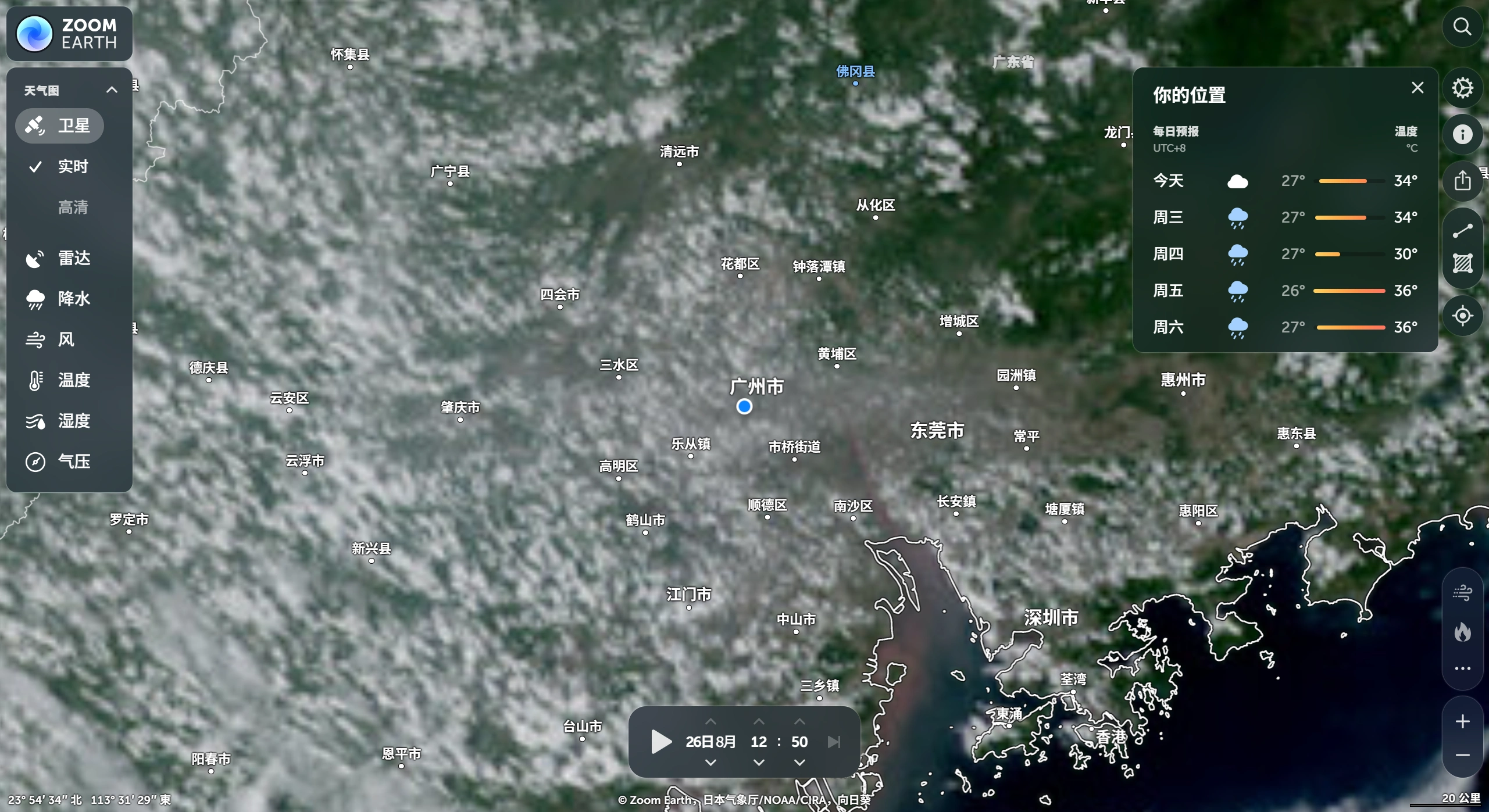
Zoom Earth Features
Real-time satellite imagery: Satellite maps updated every 10 minutes. Includes daytime visible light imagery, infrared imagery, and water vapor imagery, allowing you to clearly see clouds, surface features, temperature, and moisture conditions.
Weather data: View layers such as precipitation, wind speed and direction, temperature, humidity, and pressure for a comprehensive understanding of the weather.
Hurricane tracking: Uses data from agencies like NHC and JTWC to view storm intensity and movement paths in real time, including the typhoon's current position, category, history, and forecast path.
Fire monitoring: Detects fires through NASA satellite hotspot data and shows smoke dispersion.
Historical data: Review satellite imagery and weather for any past day by dragging the timeline to see historical changes, ideal for climate research and weather event review.
7-day forecast: View weather for the next 7 days, including daily highs and lows, precipitation probability, wind speed and direction, humidity, and pressure changes.
Location search: Enter a city name or latitude/longitude to locate, and the satellite imagery and weather for that area will be displayed automatically.
Advanced tools: Measure distance between two points, display multiple weather layers simultaneously, and use split-screen comparison to compare data from different times or layers.
Zoom Earth Uses
Meteorological research: Meteorologists use it to analyze weather systems and climate.
Education: Teachers can use it as an intuitive aid when teaching geography and meteorology.
Agriculture: Farmers and technicians monitor the impact of precipitation and temperature on crops.
Aviation and maritime: Pilots and ship captains use it to avoid bad weather and ensure safety.
News: Reporters use it to present weather events in their coverage.
Emergency response: Government and rescue organizations use it to coordinate response to disasters such as typhoons and heavy rain.
Personal use: Everyday users check weather changes and plan trips.
How to Use Zoom Earth
Visit the official website: Access the Zoom Earth official website through your browser.
View real-time imagery: The homepage automatically loads a global real-time satellite map with animation playback.
Switch map types: Use the left sidebar to switch between satellite, temperature, precipitation, wind speed, and other maps.
View historical data: Use the animation control buttons on the right to play, pause, and review history.
Measurement: Click the measurement icon in the lower left corner to measure distance or area.
Settings: Click the gear icon in the lower right corner to adjust units, animation style, and time format.
Search locations: Drag the map to view any area, or search by city name or coordinates to locate.
Zoom Earth official website automatically defaults to the Chinese version upon opening.