
 Script Planner Assistant▸
 AI Apps
 AI News

VariFlight Map: Visual Air Route Query Tool Powered by Global Flight Big Data
VariFlight Map: Visual Air Route Query Tool Powered by Global Flight Big DataIntroduction
VariFlight Map is a route query tool launched by VariFlight. It allows you to look up global flight routes, supports filtering by departure airport, arrival airport, airline alliance, airline, and other criteria. It also lets you view real-time route status and export Excel data, making it ideal for itinerary planning and as a reference when redeeming points for tickets.
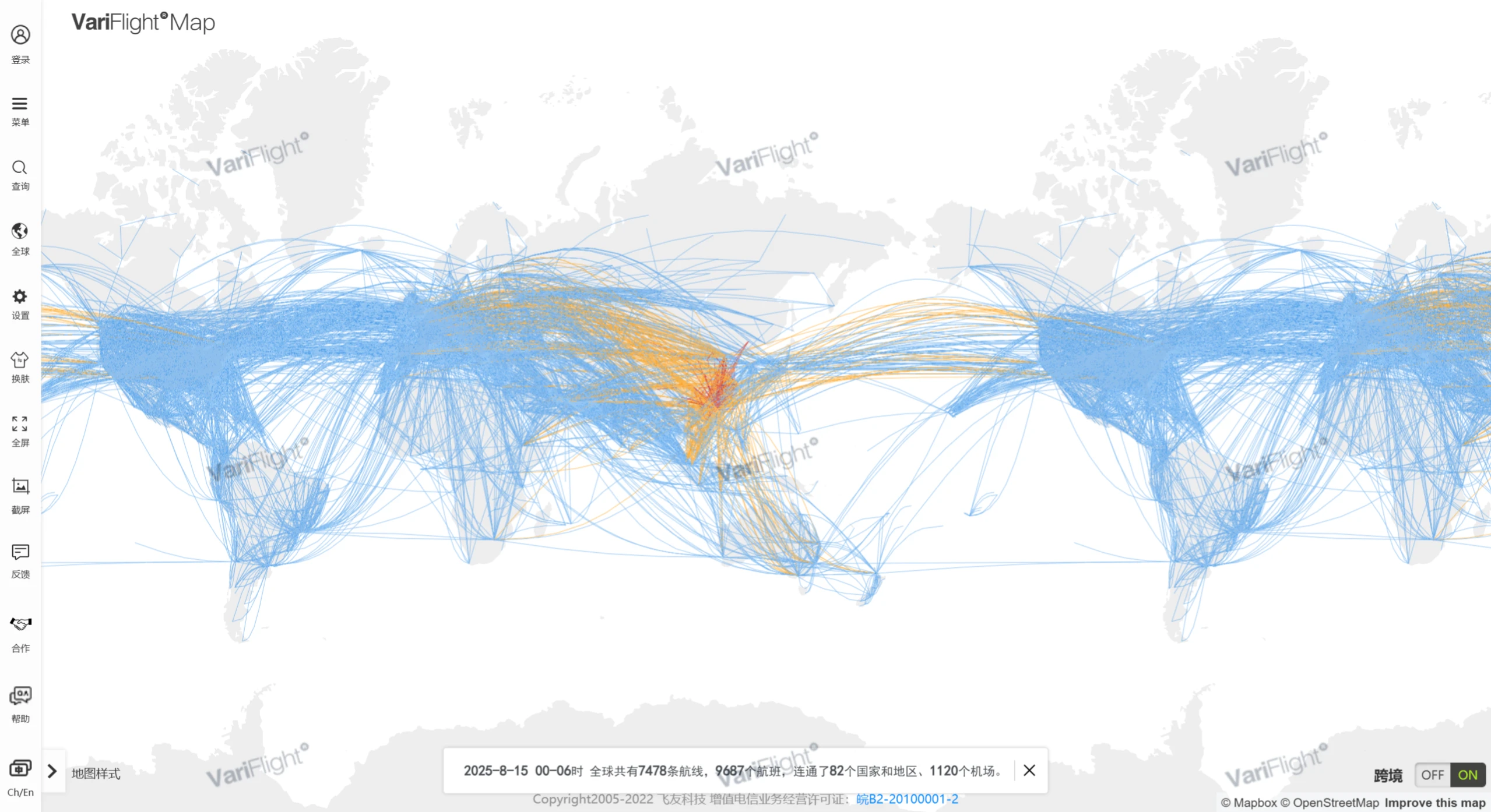
📚 Main Features of Variflight Map
Route Map Visualization: Variflight Map lets you view a global route distribution map, with filtering options by country, region, airport, and airline.
Route & Flight Search: Look up direct, connecting, and codeshare flight information between any two airports.
Route Popularity & Capacity Analysis: Display popular routes, flight density, and airline alliance distribution—useful for industry and market research.
Flight Schedules & Frequency: Show all flight timetables and frequency arrangements for a given route, making travel planning easier.
Custom Routes & Data Download: Draw your own route maps and download statistical data, suitable for reports or business use.
Real-time Flight Tracking: Monitor real-time status of flights worldwide; the map shows each aircraft's position, altitude, speed, heading, estimated arrival time, and more.
Airport Operations Monitoring: Provide real-time data on arrivals and departures, delay rates, takeoff/landing frequency, and runway usage for major airports worldwide.
Flight Weather Assistance: Combined with weather data, it alerts you to warnings along the flight path, such as thunderstorms, strong winds, and icing areas.
Flight Anomaly Notifications: Subscribe to specific flights; when flight status changes (such as delays or cancellations), the system sends reminders via email, SMS, or APP push notifications.
Data Export & API Interface: Enterprise users can access core data resources through standardized API interfaces.
📚 Who Variflight Map Is For
Airline and airport operations staff, aviation data analysts and research institutions, travel planners and aviation enthusiasts, as well as education/training and industry presentation scenarios.
📚 How to Use Variflight Map
Open the official website: https://map.variflight.com/;
Click "Route Search" in the left menu to enter the interface;
Enter the origin and destination (you can choose an airport, city, or country/region, and optionally set a transit point);
Set the time range (supports route queries from one year in the past to three months in the future) and filter criteria (such as direct flights, connecting flights, codeshare flights, etc.);
View the routes on the map—click to see flight timetables, airlines, schedules, and other details.
📚 Frequently Asked Questions
Does Variflight Map charge a fee? Basic features are free; some advanced features (such as data export and custom analysis) require enterprise partnership or licensing.
How far back does Variflight Map's data go? Routes from one year in the past to three months in the future can all be queried.
Does Variflight Map support connecting routes? Yes—just add a transit airport when running your query.
📚 What Is Variflight Map
Variflight Map (hereinafter referred to as the Route Network Map) is a map-based data product that analyzes and visualizes massive global flight route data.
What the Route Map Can Do
The Route Network Map centers on route search and route visualization, and also includes route statistics, route drawing, and airport route analysis.
Real-time global route viewing
Route search by airport, airline, aircraft type, and other dimensions
View & subscribe to flight data for routes
View/download route statistics for airports, regions, and airlines
Route drawing
Itinerary planning
Global flight distribution for airline alliances
Airport data analysis display