 Script Planner Assistant▸
 AI Apps
 AI News

NB Map: Free Online 3D Map Generator by Gray License
NB Map: Free Online 3D Map Generator by Gray LicenseIntroduction
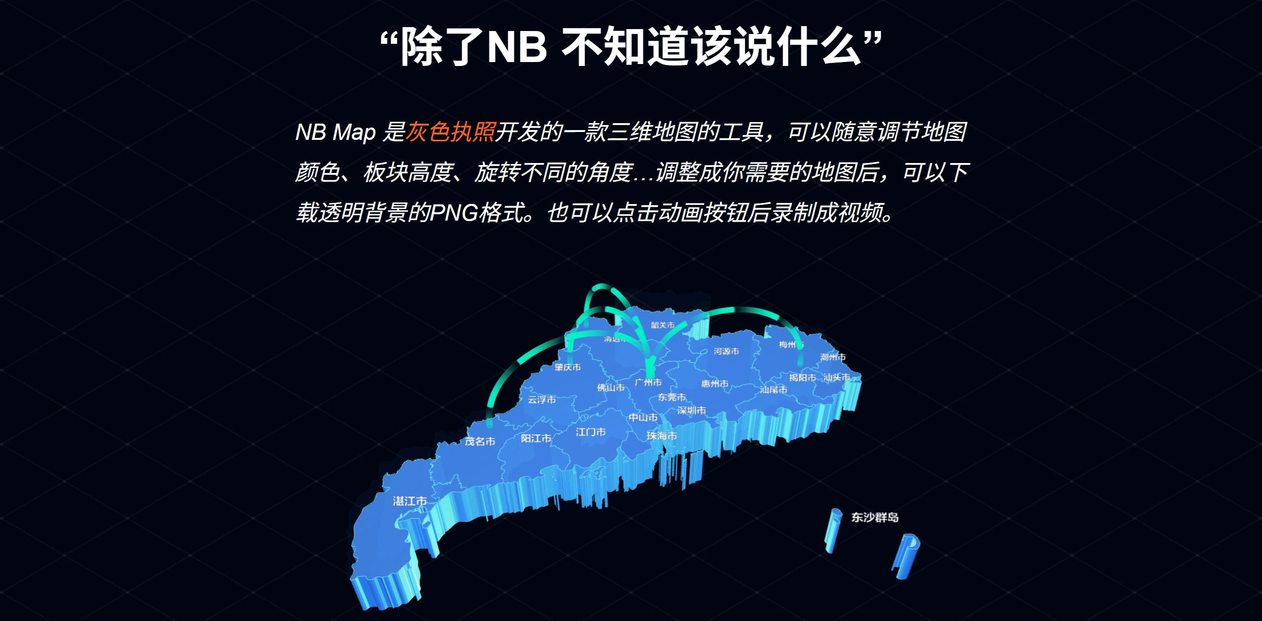
NB Map is a free online 3D map generation tool made by 灰色执照. It can generate 3D maps with elevation based on real terrain data, and allows you to rotate the view, adjust block height and color, and add lighting effects. Finished maps can be downloaded as PNG images with transparent backgrounds, GIF animations, or MP4 videos, making them suitable for use in PPT, posters, and videos.
Features
✅ Capable of generating 3D maps, covering more than 200 countries and regions worldwide, as well as provinces, cities, counties, and towns in China.
✅ Allows you to customize map color, block height, rotation angle, and more.
✅ Finished maps can be downloaded as high-definition PNG images or recorded as MP4 videos.
✅ Supports camera animation recording, which can be captured using desktop screen recording tools.
✅ Supports uploading SVG files and JSON data to automatically generate custom maps.
✅ Completely free, with source code and documentation available on GitHub.
Tool Functions
✅ Freely adjust map color, block height, and rotation angle.
✅ Adjusted maps can be downloaded as PNG with transparent backgrounds.
✅ Click the animation button to record the map as a video.
Map Coverage
✅ China Map: Includes all provinces, municipalities, and autonomous regions, such as prefecture-level cities in Beijing, Tianjin, and Hebei, etc. Sansha City is not included in Hainan, while Hong Kong, Macau, and Taiwan regions are included.
✅ World Map: Several versions are available, including a standard world map, a map with Antarctica, and a plates-only version, covering many countries and regions (such as Afghanistan, Albania, China, etc.), as well as continents (such as South America, Europe, etc.).
How to Use NB Map
✅ Visit the Website: Enter the NB Map URL in your browser.
✅ Select a Region: Use the dropdown to choose the area you want to map.
✅ Personalize Settings:
Basic Settings: Change the map background color, position, and rotation angle.
Block Settings: Adjust the thickness, color, side color, and transparency of the blocks.
Line Settings: Change the color, transparency, and distance of the lines between blocks.
Lighting Settings: Adjust the lighting on the blocks to enhance the 3D effect.
Local Adjustment: Modify the selected block to highlight it.
Font Settings: Change the style, size, and thickness of the text on the map.
✅ Generate Map: Once set, you can download a high-definition PNG image or record an MP4 video.
Use Cases
✅ Geography Teaching: Help students understand terrain changes more intuitively.
✅ Business Presentations: Create sales region distribution maps, store coverage maps, etc., to clearly display data differences.
✅ Education and Teaching: Demonstrate terrain changes, regional economic distribution, etc., to make classes more interactive.
✅ Data Visualization: Analyze crime rates, population density, etc., using 3D maps to identify trends.
✅ Content Creation: Create travel route animations, city promotional videos, etc.
About the Developer:
灰色执照 is an idea-thoughtful middle-aged person who wants to create a plugin with global influence. He has already created many products and will continue to develop more in the future. Users who purchase VIP can obtain a perpetual license to all his products, including future ones.
A few years ago, he transitioned from being a UI designer to working in data visualization. Because drawing Wuhan city map boundaries using the PS pen tool at work was too time-consuming, he wanted to create a tool to handle this in bulk. After learning programming, he developed the NB Map tool to help those in need, and it's available for free.