
 Script Planner Assistant▸
 AI Apps
 AI News

Metro Line Hub: A Global Subway Route Finder
Metro Line Hub: A Global Subway Route FinderIntroduction
Metro Line Hub is a website that provides global metro line maps and query guides, helping users understand metro systems and plan travel routes.
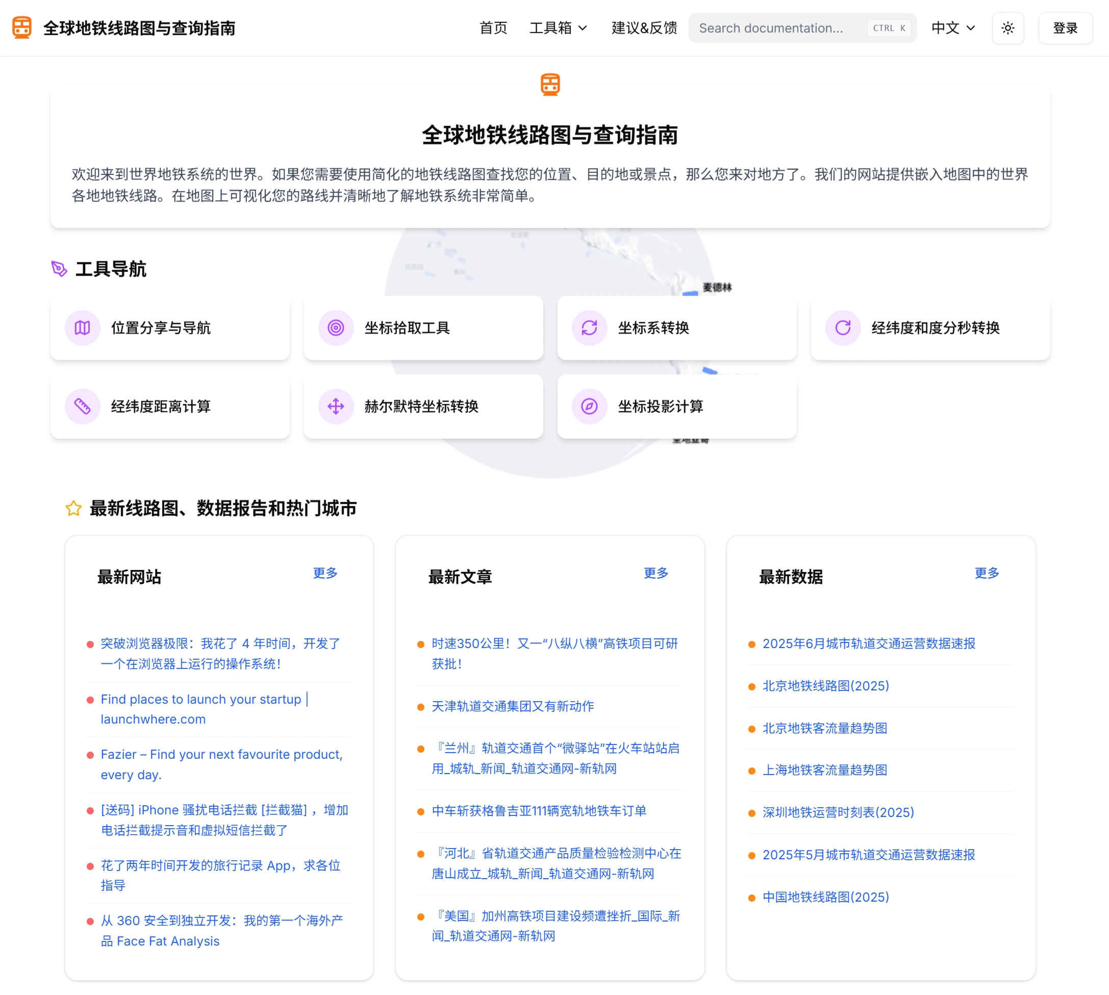
Website Features & Highlights
✅ Rich data: Covers metro lines in many cities around the world, including line names, station names, and latitude/longitude coordinates, suitable for transportation analysis and planning. For example, when querying the Hangzhou metro, users can clearly see all operating lines and station information. Some cities also provide real-time operational information, such as passenger flow management and temporary closure notices, making it easier for users to plan trips.
✅ Global coverage: Includes metro systems from major countries and regions around the world, with comprehensive and detailed information.
✅ Clear categorization: Uses a "Continent → Country → City" directory structure, allowing users to quickly find their target city.
✅ Visual operation: Provides simplified metro line maps and embedded map functionality, allowing users to intuitively view metro systems, ideal for non-professional users to quickly grasp line relationships.
✅ Focused functionality: Focuses on metro line maps and basic queries, with simple pages, fast loading, and compatibility with both desktop and mobile devices, convenient for use in mobile scenarios.
Use Cases
✅ Personal travel: Helps users understand metro lines in advance, plan optimal routes, and save travel time.
✅ Tourism: Makes it easy for tourists to understand metro lines in destination cities and reach attractions conveniently.
✅ Professional research: Provides data support for transportation planners and urban planners for transportation network analysis and urban planning research.
How to Use
✅ Visit the Metro Line Hub official website.
✅ Use the "Continent → Country → City" directory structure to find your target city.
✅ Click into the city page to view the metro line map.
✅ Use the geographic coordinates tool:
Location sharing: Share locations via links for others to view and navigate easily.
Coordinate picking: Obtain precise latitude and longitude of any location on the map.
Coordinate conversion: Supports conversion between multiple coordinate systems.
Distance calculation: Calculate the distance between two points.
Key Questions
✅ Question 1: What is the main purpose of Metro Line Hub?
Answer: To provide global metro line maps, helping users understand metro systems and plan travel.
✅ Question 2: Which continents' metro line information does Metro Line Hub cover?
Answer: It covers metro line information from Oceania, North America, South America, Asia, and Europe.
✅ Question 3: In the Asian region, which countries and major cities' metro lines does Metro Line Hub mention?
Answer: The countries and cities mentioned in the Asian region are: Jinhua, Lanzhou in China; Delhi, Kochi in India; Shiraz, Tabriz in Iran; Fukuoka, Hiroshima in Japan; Almaty in Kazakhstan; Singapore; Busan in South Korea.