
 Script Planner Assistant▸
 AI Apps
 AI News

OldMapsOnline: A Digital Map Platform Offering Historical Maps from Around the World
OldMapsOnline: A Digital Map Platform Offering Historical Maps from Around the WorldIntroduction
OldMapsOnline is a practical online digital map platform dedicated to providing historical maps from around the world, which users can browse and search for free. The platform was jointly established by multiple libraries, archives, and map collection institutions, with the goal of making it easier for the public to access valuable historical geographic materials.
Main Features
✅ Rich collection of historical map resources: The platform brings together maps from around the world spanning from ancient to modern times (mostly from the 19th century and earlier), including city maps, topographic maps, military maps, nautical charts, and more.
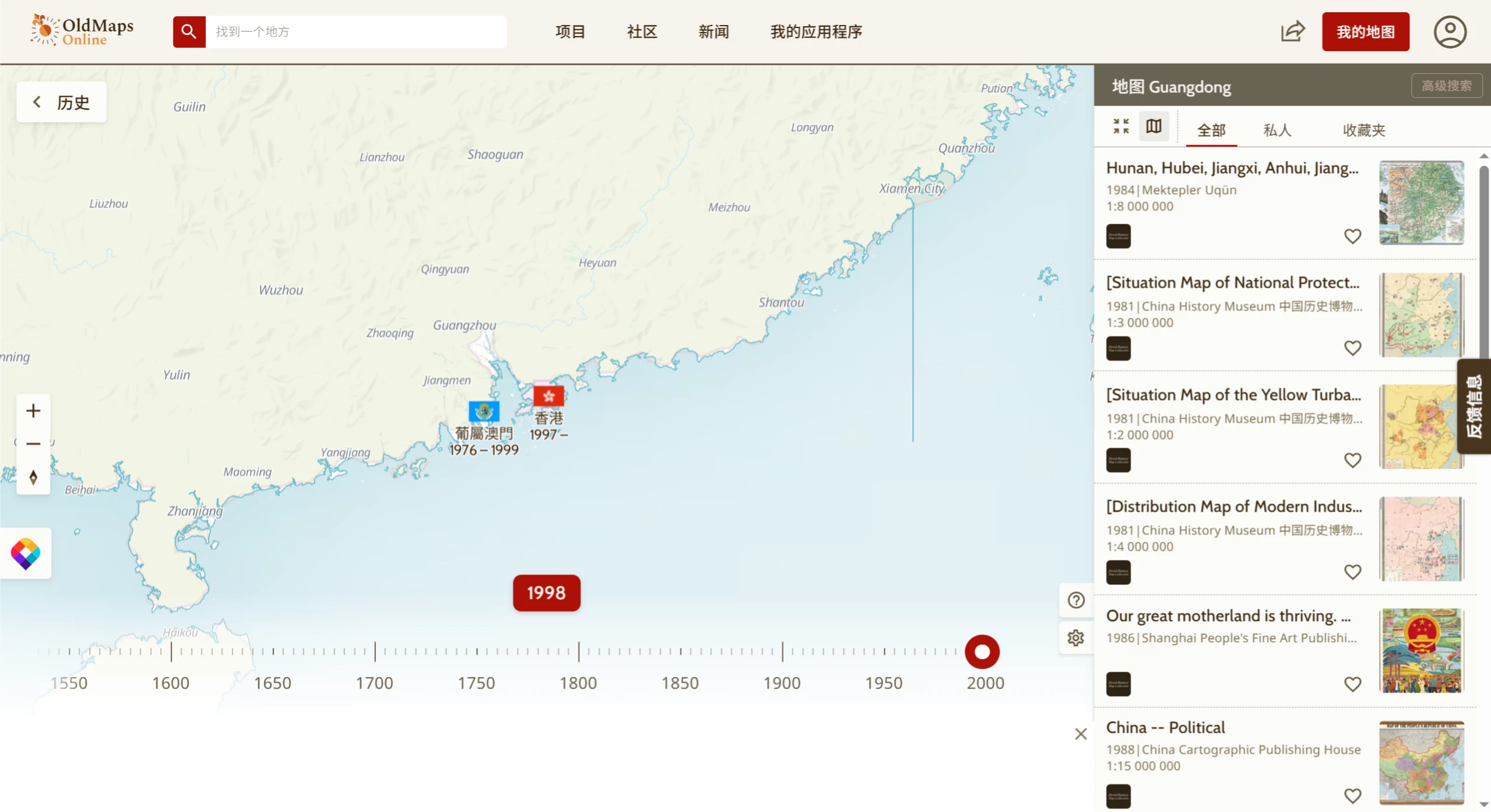
✅ Intuitive spatiotemporal search: Through an interactive interface that combines a map with a timeline, users can select a region of interest and an approximate time period, and the system will automatically filter out historical maps of that area during the corresponding era.
✅ Multi-institution collaborative resources: Partners include the British Library, the Library of Congress, the National Library of the Netherlands, the National Library of Scotland, and more. These institutions upload their digitized historical maps to the platform, making them uniformly searchable and viewable by users.
✅ High-resolution images and detailed information: The maps are mostly high-resolution scans, with most supporting zoom-in viewing of details. Each map also comes with basic information such as the date of creation, cartographer, scale, and the collecting institution.
✅ Completely free to use: All maps are available for free online viewing, and some can be downloaded (subject to copyright restrictions). Suitable for historical research, teaching, travel reference, or personal interest exploration.
How to Use OldMapsOnline?
Open the official website: https://www.oldmapsonline.org
Click or drag on the map on the homepage to select the region you're interested in.
Use the time slider on the left to set the year you'd like to view (e.g., 1800, 1850, etc.).
The system will display the available maps of that region for the selected time period; click to view details and high-resolution images.
You can also use the search box at the top of the page to directly enter a place name, map title, or keyword to look up maps.
Common Use Cases
✅ Historical research: Find maps from a specific historical period to help reconstruct the geographic environment, administrative divisions, or transportation routes of the time, providing background support for research.
✅ Geography teaching: Help teachers and students compare geographic changes across different periods, gaining an intuitive understanding of how geographical knowledge has evolved.
✅ Cultural heritage preservation: Provide historical geographic references for the study and restoration of heritage sites.
✅ Personal interest: Satisfy curiosity about the historical appearance of a particular place, exploring the "past" of your hometown or travel destination.
Platform Advantages
✅ Easy to use: No registration required; simply open and use. Search operations are simple, allowing you to quickly find the target map.
✅ Diverse resources: Brings together collections from many important institutions worldwide, with broad coverage of map types, regions, and time periods.
✅ Clear imagery: Maps are displayed in high-resolution format, supporting zoom for easy viewing of details.
If you're looking for a map of a Chinese city during the Qing Dynasty, or a topographic map of a place in 19th-century Europe, give OldMapsOnline a try — you may be pleasantly surprised.