
 Script Planner Assistant▸
 AI Apps
 AI News

Anitabi: Find Real-Life Locations Featured in Your Favorite Anime
Anitabi: Find Real-Life Locations Featured in Your Favorite AnimeIntroduction
Anitabi (Anime Pilgrimage Map) is a tool designed for anime enthusiasts. It allows you to look up the real-world locations featured in anime as well as matching screenshots. It includes a wealth of pilgrimage information for many anime and manga works, making it easy to search.
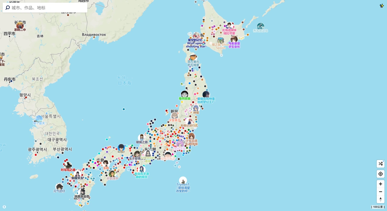
Core Features
Smart Search: Search by work or character — enter an anime title, character name, or voice actor to bring up related screenshots and locations; or search by city or landmark — enter a place name or coordinates to find the corresponding filming location; you can also choose the latest updates, recent new releases, or popular works from the dropdown menu.
Dual-Screen Synergy: The left side shows anime scene screenshots, marked with the episode number and timestamp, while the right side synchronously displays the real-world filming location, where you can switch between Street View and satellite imagery.
Route Planning: Select multiple locations, and the tool will automatically generate the optimal walking, subway, or bus route. You can also export a KML file to use in Google Earth or Amap.
Other Features
Users can click a spot on the map to submit a landmark screenshot, which will be displayed once approved; they can also mark the number of pilgrimage works in each prefecture online, generate an image to share, and use the built-in online tool to compare anime scenes with real-life locations.
Data Coverage
Includes filming locations from over 5,000 anime works worldwide, from Japan to China, covering everything from classic series to the latest popular hits.
Use Cases
Great for looking up anime filming locations and planning trips, helping fans find the real-world prototypes of anime scenes to visit in person. Travel agencies can also use it to plan anime-themed tourism routes.
Anitabi Map User Guide
Basic Use:
Open the website (https://anitabi.cn/map). You can search for works, characters, cities, or landmarks (for example, enter "Your Name." to find Lake Suwa).
Click on the coordinates in the search results to view a side-by-side comparison of anime screenshots and real-world maps. Some scenes allow you to switch between Street View and satellite imagery.
Direct coordinate input is supported (e.g., "35.6895,139.6917" will locate Tokyo Skytree).
Special Features:
Dual-Screen Synergy: The left side shows anime screenshots marked with episode and timestamp, while the right side synchronously displays the real location, allowing you to compare screenshots against real-life views.
Route Planning: Link multiple landmarks together to generate the optimal walking, subway, or bus route. Export a KML file to navigation apps (such as Amap or Google Earth).
Community Contribution: Users can upload new landmark screenshots and add work information, building a dynamic, collaboratively maintained database.
Multi-language Support: Available in Chinese, Japanese, and English, making it accessible to users in different regions.
Advanced Usage:
Add filming landmarks from Bangumi detail pages to enrich work information.
Use the "Pilgrimage Landmark Widget" to quickly view nearby scenes, with offline marking supported (requires downloading the companion tool).
Note: Some features (such as route export) require an account, and your data syncs between mobile and desktop.
Compared with similar tools like Japan's "聖地巡礼マップ", What are Anitabi Map's advantages?
Broader Coverage: Not limited to Japan — includes filming locations from over 5,000 anime, manga, and game works worldwide, such as "Your Name." and "Demon Slayer", and even covers local Chinese scenes (for example, the Fujian Tulou from "Big Fish & Begonia").
Smarter Search: Supports multi-dimensional search by work, character, landmark, or coordinates. For instance, searching for "Miss Railgun" brings up related scenes from "A Certain Magical Index", and entering latitude and longitude directly jumps to the location.
Excellent Dual-Screen Synergy: The left side shows anime screenshots marked with episode and timestamp, while the right side synchronously displays a real-world map. You can switch between Street View and satellite imagery to recreate the pilgrimage scene.
Practical Route Planning: Link multiple landmarks together to generate the optimal walking, subway, or bus route, and export a KML file to navigation apps — ideal for in-depth pilgrimage planning.
Open Community Interaction: Users can upload new landmark screenshots and add work information, forming a dynamic, collaboratively built database. Offline marking tools are also available for on-the-go note-taking.
Language-Friendly: Provides interfaces in Chinese, Japanese, and English, making it convenient for overseas fans.
Related Information: